
The Chengdu Central City project was undertaken to access the current urban flood risk, gain an understanding of the underlying causes of the problems and provide engineering and non-engineering management solutions for the five demonstration areas of the city. The total project area was approximately 300km2, and required extensive modelling to complete the project objectives of providing flood maps and provide the knowledge and ability to comprehensively assess engineering and non-engineering solutions for the city.
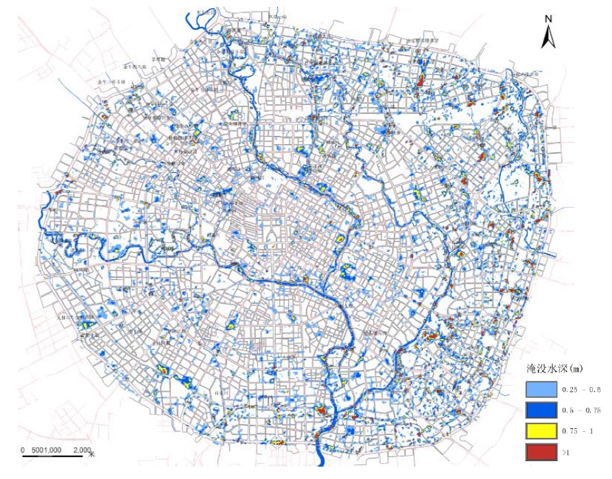
Design storm water points and depth distribution in the central city of Chengdu every 6 hours in 100 years
Ewaters was responsible for Designing and establishment of hydrologic and hydraulic river model encompassing 82 rivers, including a 2D model area of 300km2, and 1D-2D coupling mode for the demonstration areas;? assessment of the rivers' flood control and drainage capacity, identification of areas with risk of river bank overflow, areas with risk of urban flooding under extreme rainfall events and the completion of flood maps;? identification and detailing of the major causes of urban flooding in the demonstration areas;? preparation of engineering and non-engineering methods to improve the drainage capacity in the whole region, including establishment of overland flow path access into retention ponds in parks and storage ponds, renovation and expansion of pumping stations and network pipes and improvement of flood risk warning system and emergency measures.
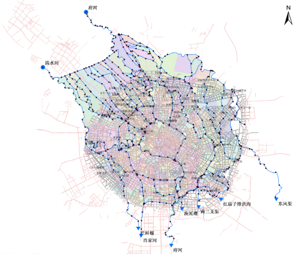
Chengdu River network generalized model